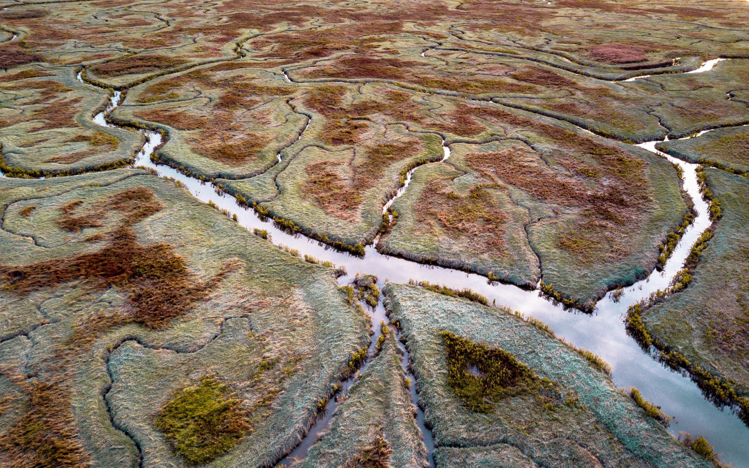
The Drowned Land of Saeftinghe is a 3,500 hectare peat bog turned salt marsh and wildlife preserve situated on the border between Belgium and the Netherlands. Once inhabited by people, it has since been reclaimed by the waters of the Western Scheldt.
Local legend likens the flooding of Saefthinge’s villages to the sinking of Atlantis: of vain, proud, silk-sporting peasants and their silver-harnessed horses chasing away impoverished migrants looking for their promised land, and being punished by an Old Testament god as a result.
Needless to say, this legend is only half true. Yes, Saeftinghe flooded to the point that human settlement was no longer possible. But it wasn’t any deity that caused the flood: it was the inhabitants themselves.
The Drowned Land of Saeftinghe in the Netherlands. Photo: Arterra/Universal Images Group via Getty Images.
During the end of the last Ice Age, melting glaciers sent water flowing across northern Europe. Zeeuws-Vlaanderen, the region in which the Drowned Land of Saeftinghe is located, must have seen a particularly large quantity of water—so much that it couldn’t fully drain into the North Sea, sank into the sandy ground, and turned the area into one giant peat bog.
In the 13th century, Saeftinghe was drained by the Ter Doest Abbey, which also oversaw land reclamation in Flanders and Holland—with one of its lay brothers, Willem van Saeftinghe, lending his name to the area. Over centuries, the site served as fertile farmland, housing small villages and Saeftinghe Castle, constructed in 1279 and expanded through the 14th century.
In 1570, a flood wiped a large part of the town off the map. The torrent, remembered as the All Saints’ Flood, devastated the entire coast of the Netherlands; in Saeftinghe—where the ground had been sinking further and further below sea level due to farmers draining bods to extract peat—the waters claimed land and lives.
Reproduction of a map of the Scheldt from Rupelmonde to the North Sea, with Saeftinghe Castle depicted in the bottom half, toward the left (ca. 1500–10). Photo: public domain.
The Eighty Years’ War dealt Saeftinghe further hefty blow in 1583, when—during a nearly century-long conflict between the Netherlands and Spain—its own inhabitants are believed to have broken a nearby dam to prevent the nearby city of Antwerp from falling into hands of the Spanish Empire.
After the end of the war, Saeftinghe limped on until 1715, when another great flood rendered the area uninhabitable. “The Drowned Land of Saeftinghe is now an outer dike area with silted up and overgrown salt marshes, bare mud and sand flats, channels, gullies and creeks,” the official website of Geopark Schelde Delta reads.
Several attempts were made to reclaim parts of the Drowned Land between the 14th and 20th century, the most recent of which took place in 1907 under the supervision of the Duchess of Hedwig Polder, a constituency to Saefthinge’s southeast.
While the Dutch and Belgian governments have the knowledge and resources to fully reclaim Saeftinghe from the Schelde and the North Sea, they long ago made a conscious decision not to. Not because the land is without value, but because nature has slowly reverted the peat bog into a wildlife preserve. Birds especially flourish in Saeftinghe, making the area a popular destination for avian enthusiasts in search of endangered species like bearded reedlings, bluethroats, and reed warblers. All that remains of its one-time settlement are several large bricks, on view at a nearby visitors center; the location of its castle is lost.
The Hunt explores art and ancient relics that are—alas!—lost to time. From the Ark of the Covenant to Cleopatra’s tomb, these legendary treasures have long captured the imaginations of historians and archaeologists, even if they remain buried under layers of sand, stone, and history.