The Norwegian village of Avaldsnes is a former Viking stronghold. According to the town’s historical society, the Norwegian defense fleet was able to mobilize approximately 310 ships in times of war. Not only that, there were probably several thousand privately owned ships of notable size. When leaders died, they would be buried in their ships in large burial mounds.
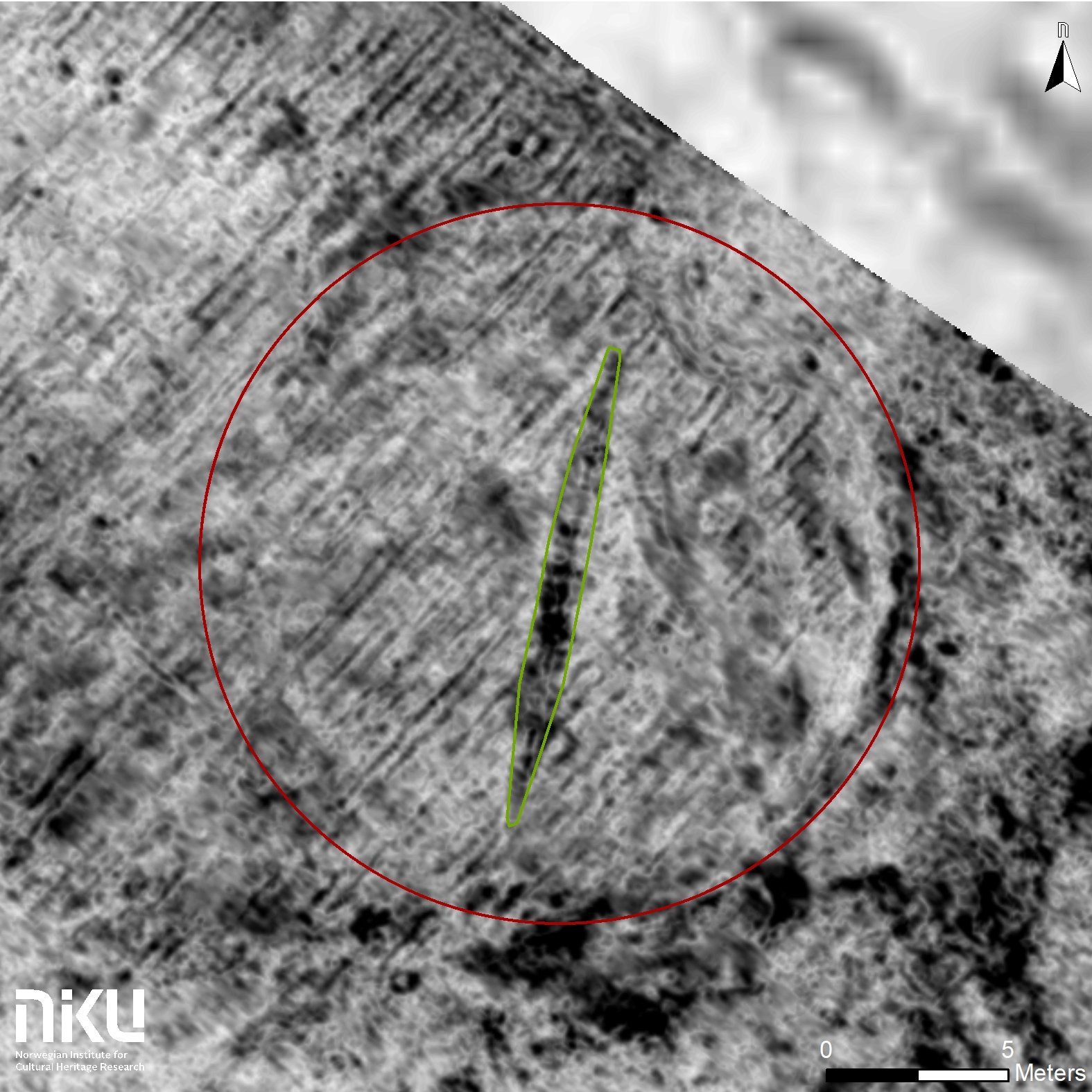
But finding them is rare; only 15 or so Viking ships have been excavated thus far. So archaeologists with the Norwegian Institute for Cultural Heritage Research (NIKU) were very excited last month when they found what appears to be either a Merovingian or Viking period burial site in Edøy, a tiny island in the archipelago to the west of Trondheim. They made the discovery thanks to georadar technology.
The georadar used in the discovery of the Viking ship is seen in front of Edøy Church, where archaeologists originally looked before finding evidence of the Viking ship in a farmer’s field.
“We only know of three well-preserved Viking ship burials in Norway, and these were excavated a long time ago. This new ship will certainly be of great historical significance and it will add to our knowledge as it can be investigated with modern means of archaeology,” says Dr. Knut Paasche, Head of the Department of Digital Archaeology at NIKU, and an expert on Viking ships.
The ship in Edøy was found using the same techniques—ground-penetrating georadar developed by LBI Arch Pro research institute and its partners (including NIKU), using technology from Guideline Geo, which canvases the earth like an artifact-hunting Zamboni—that have previously been used to detect landmines in former warzones.
The ship was found by NIKO archaeologists Manuel Gabler and Dag-Øyvind Engtrø Solem, who were surveying an area near Edøy Church in September of 2019. They had finished surveying the area and had a little extra time, so they decided to use the georadar on a nearby farm. That’s where they unexpectedly detected the ship, buried in a mound in a farmer’s field.
“As the technology is making leaps forward,” Dr. Paasche says, “we are learning more and more about our past.”
Though the finds are still considered rare, the new technology has helped archaeologists make two such major discoveries in the past two years. In 2018, a perfectly intact Viking ship was found in Gjellestad just below the topsoil, where evidence suggests there was previously a large burial mound that had been flattened by farm equipment. The Edøy case is nearly identical.
The georadar data shows that the ship in Edøy has an over 42-foot-long keel (a long piece of wood that serves as the ship’s backbone). The ship’s front and back look to have been damaged by agricultural plows, but the hull appears intact.
“The length of the keel indicates that the ship may have been a total of 16–17 meters [52–55 feet] long. It is too early to say anything certain about the age for the ship, but the ship must be from the Merovingian or Viking Period. Which means the ship is more than 1,000 years old,” says Paasche.
According to Ars Technica’s Kiona N. Smith, who first reported on the story, the farmer whose land the ship was found on is named Per Hassle. Despite his name, the archaeologist Solem told Smith, Hassle has been very cooperative. “The burial is indeed located on a working farm, but we couldn’t have wished for a more agreeable landowner. He is very interested in history, especially local history, and is very enthusiastic about the project,” Solem said.
NIKU plans to go ahead with an excavation in the near future, as well as exploring larger parts of Edøy area in hopes of finding other Viking artifacts.