Art World
Amid Record Heat, England’s Bone-Dry Soil Is Revealing the Long-Hidden Patterns of Ancient Buried Ruins
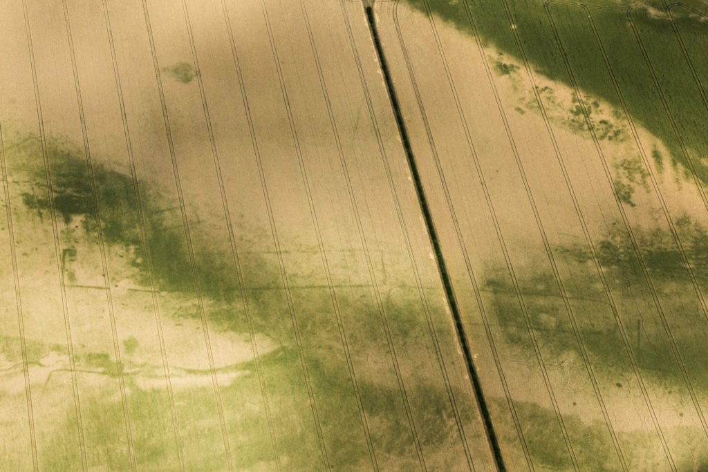
See the aerial photographs that reveal what has been uncovered by the heatwave.
See the aerial photographs that reveal what has been uncovered by the heatwave.
Javier Pes
 ShareShare This Article
During Britain’s long, hot summer, archaeologists have been making hay, discovering scores of ancient sites from the air that have been revealed by the record-setting heatwave. Stone Age monuments, Iron Age settlements, a Roman farm, and the foundations of an Elizabethan hall are among the sites spotted from the air. Cropmarks, the telltale signs of buried structures, are more obvious when the soil is very dry.
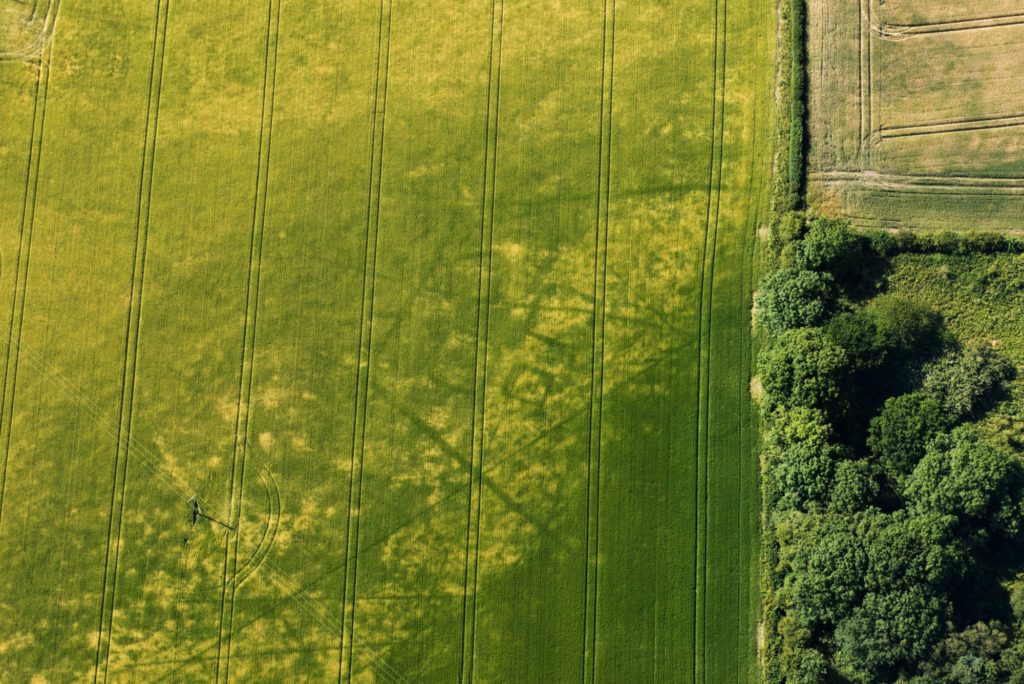
Among the finds are two Neolithic monuments near Milton Keynes in the Midlands of England. The heatwave revealed the evidence of ancient processional routes, some of the UK’s oldest types of monuments, typically dating back more than 5,000 years ago. There are only around 100 such monuments known in England.
It is quite a discovery for the new town, which only celebrated its 50th birthday last year. Matthew Oakey, the aerial investigation and mapping manager for Heritage England in the north, says that Neolithic finds are among the earliest that they see using photography. He says that he expects more sites to be revealed as this summer’s photographs are studied.
Cornwall in the West of England is well known for its numerous ancient sites. The heatwave revealed a dozen more, including a prehistoric settlement.
Iron Age square barrows, Pocklington, Yorkshire. Photo: Emma Trevarthen. Copyright Historic England.
Helen Winton, who is in charge of aerial investigation at Historic England, said in a statement: “2011 was the last time we had an exceptional year when we discovered over 1,500 sites.” Oakey and his colleagues in England, Wales and Scotland have had a busy summer. Discoveries are being made in areas that do not normally reveal cropmarks, he says. Experts are predicting a “bumper year.”
The flying archaeologists have even made new finds at well-known sites, such as lost Elizabethan buildings and gardens associated at Tixall Hall in Staffordshire in the West Midlands of England. The historic gatehouse still stands but nearby are the newly revealed foundations of a new hall that was begun during the World War I but never completed. It was demolished in 1926 around the time aerial archaeology was getting off the ground in England.
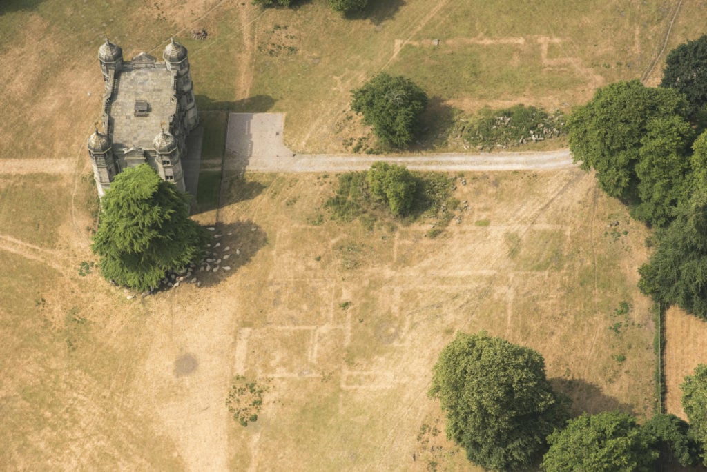
The Elizabethan gatehouse of Tixall Hall, Staffordshire. The grass is dying back over the buried foundations of Tixall Hall which was built in 1555. Photo: Emma Trevarthen. Copyright Historic England.
After the Great War, there were trained pilots, spare planes, and the skills to interpret aerial photography, which had developed rapidly during the conflict to meet the needs of military intelligence on the Western Front.
Two veterans, O.G.S. Crawford, who had been an observer in the Royal Flying Corps, and Alexander Keiller, who flew in Royal Naval Air Service and served in air intelligence, joined forces and became pioneers of aerial archaeology in the 1920s. They published their first survey, Wessex from the Air, in 1928.
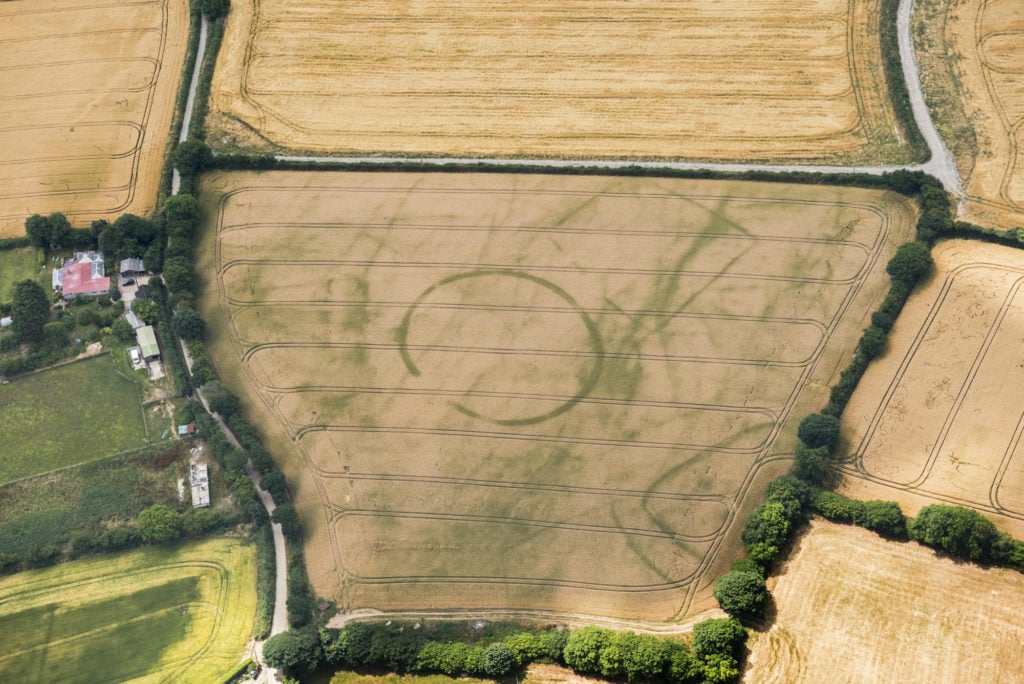
Aerial evidence of two Neolithic monuments near Clifton Reynes, Milton Keynes. Photo Damian Grady. Copyright Historic England.
Keiller, who was heir to a marmalade fortune, bought the great stone circle at Avebury and nearby Windmill Hill in Wiltshire, opening an archaeology museum there. He donated the land to the nation and his widow, another pioneering aerial archaeologist, donated the museum.
Even in the digital age, interpreters use similar equipment and skills to spot “lumps and bumps” that could be clue to Britain’s hidden history. But the abnormal weather is making that past a little easier to spot.