Excavations around the world have ceased activity as archaeologists observe widespread stay-at-home orders. But that didn’t stop a British wedding photographer from making an intriguing archaeological discovery of his own—without ever leaving his house.
Chris Sedden found himself out of work during the shutdown as government restrictions put an end to weddings and other large gatherings. But the break in his normal routine afforded Sedden the opportunity to put on his amateur archaeology hat and spend hours pouring over images of the terrain surrounding his home in southern Derbyshire.
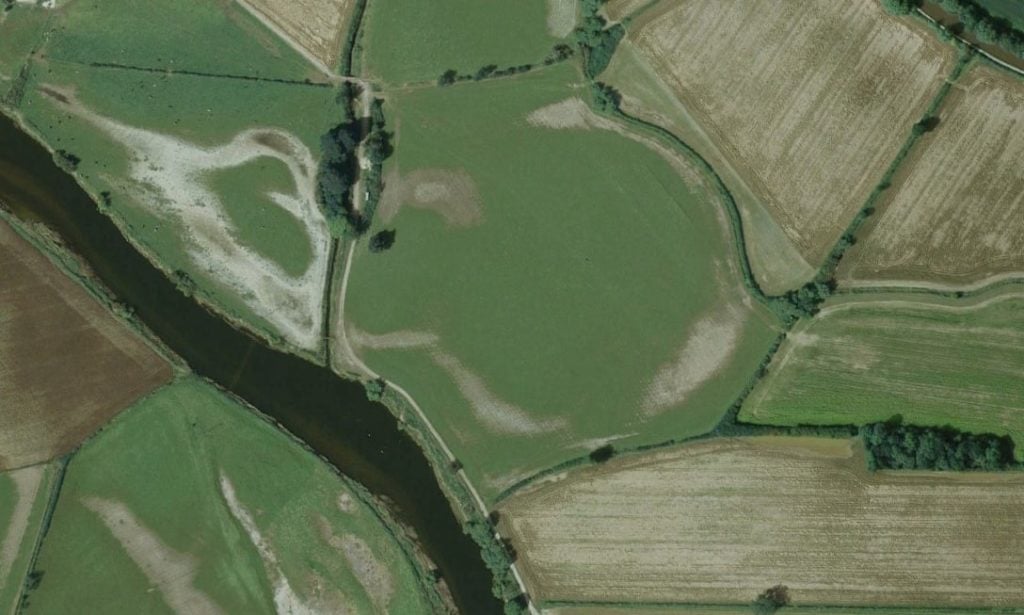
As he scanned along the River Trent, near the village of Swarkestone, he noticed something strange. “I thought, ‘what’s that? It looks a bit odd, and a bit round,’” Sedden told the Guardian.
The strange shape was clearly visible in aerial photos, with brown patches in the grass suggesting that there had once been a stone structure there. (Summer droughts sometimes reveal similar spotting at Stonehenge, indicating where the missing stones would have once been.)
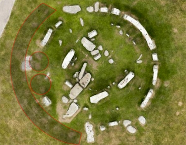
An aerial view of Stonehenge. Photo: SWSN.com/English Heritage.
Even more compelling were the Light Detection and Ranging images that Sedden found of the area online. LiDAR scans, as the process is commonly known, involves taking topographical readings using laser-equipped aircraft. The result is a three-dimensional map of the earth’s surface that can reveal the long-lost remains of a structure.
LiDAR is a revolutionary tool for archaeologists, helping them spot large, low-lying formations that aren’t readily apparent on the ground. It has particularly transformed our understanding of Mayan archaeology, with LiDAR scans that have revealed thousands of ancient structures and fortifications that would have taken centuries to map on foot.
For armchair archaeologist Sedden, the more he examined images of the area, the more he began to suspect that the faint circular formation was in fact the remains of an ancient structure, a “losthenge” similar to Stonehenge. There are other known Neolithic sites nearby, which helps support Sedden’s theory. And the historic boundaries of the surrounding fields conform to the formation, suggesting that farmers may have been organizing plantings around an existing structure.
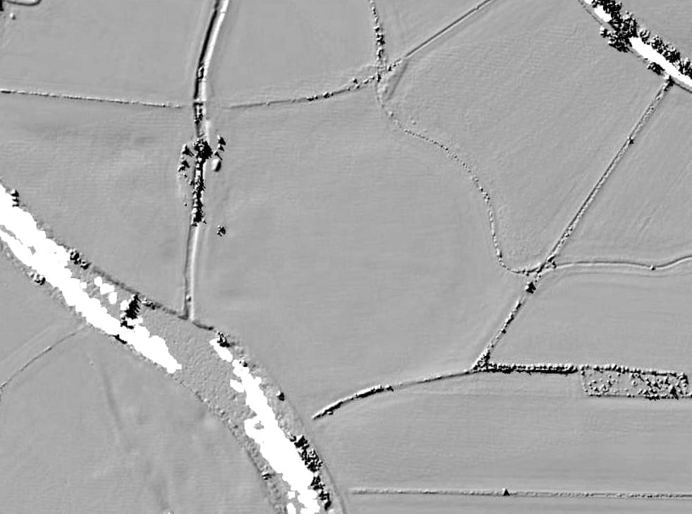
Wedding photographer Chris Sedden spotted what could possibly be traces of a newly discovered henge in the village of Swarkestone in south Derbyshire in an aerial photograph, and a topographical LiDAR scan backed his hypothesis.
So when Sedden enrolled in an online archaeology course with DigVentures—joining some 4,000 archaeology enthusiasts from 69 countries around the world in a new lockdown passion—he quickly shared his theory with the class. His instructors, professional archaeologists, were just as excited as he was.
“Of course, we are all just itching to get out there and investigate,” Lisa Westcott Wilkins, managing director of DigVentures, told the Guardian. But even without in-person confirmation of the find, “we are very happy to say that this does indeed look like a ‘thing.’”
